Friday 29 July 2011

Harter Fell


As the small car park by Jubilee Bridge was full, we parked in one of the lay-bys on the narrow road leading to Hardknott Pass.
We walked the short distance up the road towards the Pass, then at the car park, we crossed Hardknott Gill on a small stone footbridge and then followed the bridleway as it gradually rose along the flanks of Birker Fell.
The heights were in cloud as we continued now climbing a bit more steeply on a fairly well-defined footpath. We soon reached the summit and found a spot sheltered from the breeze to have our lunch but because of the conditions, the midges were out and we were soon starting to be THEIR lunch!
We moved around to North-West side and luckily the cloud was now patchy so we could see quite expansive views down to Hardknott Pass below and the old Roman fort at its foot. We could also see across to Eskdale Fell and Stony Tarn.
But, soon, the midges were back, so we returned back down following the same route as before. Luckily, the cloud had now largely gone with brilliant views up Esdale towards the Scafell Massif, Crinkle Crags and Bow Fell.


Thursday 28 July 2011

Stanley Force

While we were sorting out breakfast, it began to rain so we sat in the tent porch reading for a couple of hours until it had stopped. We decided on a short walk locally to see a very beautiful waterfall.
We drove the short distance to the small car park by Dalegarth Bridge and walked along a path through woods following a stream and after crossing a footbridge to the opposite bank, we were in the ravine where the very picturesque waterfall called Stanley Force could be found.
There was a Pied Wagtail flying back and forth with a beak-full of insects obviously feeding young birds in a nest.
We retraced our route until nearly back at the River Esk and then followed a bridleway along the South bank of the river, on the way passing Low Birker Farm until we arrived at Doctor Bridge.
We crossed the bridge to the other side of the river, until we arrived at a small church. Passing the churchyard, we soon arrived at a minor road which led us back to Dalegarth Bridge, a popular site for jumping off the parapet into a deep pool below.


Wednesday 27 July 2011

Crinkle Crags

A very enjoyable walk traversing Crinkle Crags, starting at Cockley Beck Bridge. We started by following the bridleway on the west side of Moasdale Beck for a few hundred metres before cutting across to the foot of Ulpha Fell.
The way now steepened on hummocky grass as we rose up Ulpha Fell and then Little Stand where we had a short break.
There had been low cloud but luckily this now began to lift revealing the Crinkle Crag summits and Bow Fell a short distance beyond.
We joined the track leading up from the Langdales side via the route to Red Tarn and were soon enjoying views down both into Oxendale on one side and across tot he Scafell Massif.
We continued along the broad ridge wending its way visiting the various summits, pausing to wait for a few minutes at the “Bad Step” where we waited while a couple of men and a sheep dog tried to work out how to get down the short scramble with the dog.
In the end one man managed to clamber down while the second took the dog around the alternative route down.
Karen was soon up the easy, short climb an I followed.
We continued onwards passing Shelter Crags until we arrived at Three Tarns just before Bow Fell where we started to drop down valley to the West where we followed a path paralleling Lingcove Beck.
We then turned off into Moasdale and then followed this broad valley until we were back at our starting point.
Looking towards Hardknott Pass


Above the "Bad Step"


Bowfell

Tuesday 26 July 2011

Ambleside

Today we had an easy day and spent most of the day in Ambleside mainly visiting gear shops, as you would expect! We bumped into Elaine Hillyard and her other half Mike in The Climbers Shop. They were in the area in connection with a Duke of Edinburgh group.

Monday 25 July 2011

Scafell Pike

An even warmer day than yesterday and we drove around to the next valley at Wasdale to park at the National Trust car park next to Brackenclose.
Our intended route was to follow the obviously very popular route along Lingmell Gill and Brown Tongue up to the highest summit in England, Scafell Pike.
The lower section of the route was very scenic as it followed the small ravine of Lingnell Gill which then broke out into a more open area. We saw several characters making their way up the path including one man with a small speaker playing music from the 80's hanging from his rucksack and “Super Dad”, who kept steaming off into the distance leaving behind his family until he was forced to stop and wait for them to eventually catch up.
We had a brief pause at some boulders to cool down and then a longer snack break at the col between Lingmell Crag and Scafell Pike and admired the view across to Great Gable, where we managed to spot the well known feature of Napes Needle.
We continued up the continuing path until we arrived on the bouldery summit of Scafell Pike to join the throng of walkers who had already arrived. It was a lovely clear day and of course there were amazing views in every direction.
After a brief pause we continued back down the way we came passing “Super Dad's” family who were this time waiting for him as he had decided to descend via the Mickledore route.
We retraced our earlier route until we arrived back at the car park.


Sunday 24 July 2011

Whin Rigg and Ill Gill Head

We drove around to park at a small car park by the bridge in Mitredale where the narrow road ends. From here we crossed the bridge over the River Mite and followed a track into the woods of Mitredale Forest and then left the track to follow a footpath leading gradually upwards until we broke out of the woods and onto Irton Fell. It was a lovely warm and sunny day and we had excellent views across Wasdale, Mitrdale and across to the coast.
The path led over hummocky grass to reach a high point at Whin Rigg with amazing views down into Wasdale and Wastwater and the peaks such as Yewbarrow, Kirk Fell, Great Gable and the Scafell massif.
We continued onwards towards the next high point at Illgill Head and then steeply down to the valley of Eskdale Moor near Burnmoor Tarn. This brought us past a smaller wood and then back to where we had started.


"Head right for Eskdale", if you say it in the local accent...

Saturday 23 July 2011

A Week in The Lake District

Karen and I were having a holiday for a week in the Lake District. We left Winster in the morning and drove to Eskdale to camp at the Fisherground Camp Site near Eskdale Green and the Outward Bound centre where Karen used to work.

This is a very large camp site with quite a bit of “do's” and “don'ts” and a large number of families with kids taking advantage of the good weather at the start of the school holidays. One advantage of this was that the night was usually very quiet.
We got the tent (Vango Equinox 350) pitched up at the spot we had been allocated among various large “Nylon Palaces” and spent the rest of the afternoon relaxing.

Thursday 21 July 2011

DCRO Call-out To Assist in Animal Rescue

We were just about to have dinner when the phone rang. There was a young bull stuck in a mine at a farm in Kniveton.
Karen and I set off to find some Firefighters from Matlock were parked in a field with an old quarry with a large off-road Fire vehicle. Ralph and Pete were already there.
I went over to the mine entrance to find Ralph just inside with one of the Firefighters, who was wearing a full-body harness with a rope attached which was being belayed by other Firefighters using their vehicle as an anchor.
I had a quick chat with Ralph. A young bull was lying on its side some 15 or 20 metres further in and was not getting up even though it seemed to be uninjured. The route in was down a gently-sloping passage with a bit of a step.
I returned to the car and got changed into caving gear and then went in to have a look myself. The bull was indeed lying on its side and was breathing heavily and steaming, so had been active recently. It seemed to either have an injury on the side it was laying on or just simply exhausted. The way on was a dead end and another passage continued on the right next to the bull.
Near the bull was a small framework of rotten old wooden stemples with a small gap between it and the ceiling. The ceiling just there was made of jammed rocks and boulders and seemed safe enough and the stemples weren't supporting anything - which was good news.
I returned to the surface and the Firefighter in charge asked for no one else to go underground until a vet had attended the animal and sedate it.
Other DCRO personnel arrived at various points, including the DCRO vehicle, and we waited as the Firefighters accompanied the farmer to see his animal. He, too, was equipped with a harness and a belay and I leant him my caving helmet and light. But before this happened, some DCRO members had a look at the roof and agreed that it was safe.
The vet soon arrived and he was also taken to see the animal, again with a harness and borrowed helmet and light. He sedated the animal and the Firefighters attached a strop to the bull and used a winch on the front of their vehicle to drag the animal towards the entrance. They had laid a tarpaulin on the adit floor to assist in protecting the bull from injury. The winch seemed to be overloaded and they switched to just reversing their vehicle to continue dragging the bull towards the entrance.
Pretty soon the bull was back on the surface and was assisted from laying on its side to a more upright position by the vet and some farmers. The vet thought it had no major injuries but was exhausted.
A tractor arrived and the bull was placed in the large scoop on the front and driven away to be placed in a farm shed to be allowed to recuperate.
We set off for home at around 20:30 stopping off at the Miners Arms in Brassington for a quick pint.

Monday 18 July 2011

A Walk around some Old Lead Mines near Elton

Karen and I joined a group of around 15 on a very interesting walk led by Tony Wood around the fields surrounding the nearby village of Elton.
Tony pointed out many features including many sadly now lost such as spoil heaps from led mining activities which had been removed by either farming activity or by later working for Flourspar.

Sunday 17 July 2011

Lose Hill from Hope

It was already raining as we were leaving Winster and continued to do this on and off all day until it eventually simply rained without stopping!
Starting off from Hope, next to the church, then set off down Edale Road and turned left and then onto a footpath by the school leading across several fields and then across a footbridge over the railway and into further fields.
Eventually we reached a field which rose for a while to reach a stile by Lose Hill Farm. We sat on a grassy bank by the stile and had a snack then continued onwards rising up Lose Hill to arrive at the topograph on the summit. A man from another group of walkers coming in the opposite direction showed us the memorial plaque affixed to some rocks just a few metres lower on the Northern side.
Up to now there had been several short showers but now on the Great Ridge, there was also quite a lot of wind. I had been wearing my Tilley T3 Hat to keep the rain off, which it had been doing admirably, but it was now so windy, I took it off and wore my Rab Bergen Jacket's hood for a while.
Continuing along the Great Ridge as far as Back Tor, we quit the ridge via a descending path to reach Hollowford Road which we followed into Castleton.
We paused for a few minutes at a bench next to the bus stop to have a drink while Karen made use of the Public Convenience and then continued along the road towards Hope where we left the road to follow a path along the Peakshole Water stream to join the minor road from Pindale into Hope.
On the way home we first stopped off at Monyash for a meal at the café then stopped off at the Orpheus hut to wash and leave a rope Karen had used last week for her trip to Water Icicle Cavern.

Plaque at summit of Lose Hill

Saturday 16 July 2011

A Walk Around Eyam Moor

Leaving the car in the layby by the Plough pub near Hathersage, Karen and I followed the narrow road uphill past Hazleford Hall then at a bend further along, left the road for a rough track passing Tor Farm.
Soon we were dropping down the track then onto a path through woods and along the valley side above Highlow Brook before reaching the brook at Stoke Ford.
We stopped here for a few minutes for a snack then continued up the gradually-rising path through bracken following above Bretton Clough to reach the wall surrounding Eyam Moor.
There had been the odd light shower as we were walking along and as it was quite a warm day, it was a bit of a pain to have to keep stopping and putting waterproof jackets on and off. As we crossed the wall onto Eyam Moor there was a further shower which was more prolonged so we sheltered in a very small abandoned quarry until the shower was over.
We continued along the track on the moor following a field boundary until we arrived at Sir William Hill Road where we crossed a stile onto Sir William Road then back across the wall by a second stile a few metres away back onto Eyam Moor on the other side of the field boundary we had been following.
We followed a path which dropped downwards along the Moor until we eventually arrived at the road at Leam which was the same minor road we had followed at the start of the walk.
Following this section of the road, we crossed a stile into a field which cut across a bend in the road to pop back onto the road via a stile next to Hazleford Hall.
We then retraced our earlier route back to the Plough and afterwards had a snack at the café in Outside at Hathersage.


Sunday 10 July 2011

DCRO Shout at Peak Cavern

Later in the evening the phone rang around 19:50 and I answered it. It was Ralph saying someone was lost in Peak Cavern and we should stand-by in case of a call-out. About 15 minutes later he rang back to say that the call-out was going ahead and to make our way to Peak Cavern.
We collected our gear together, including warm surface gear as usual in case we were asked to do a job on the surface. On arrival at the car park for Peak Cavern we found Keith in control and I asked if I might remain on the surface as I was feeling under the weather probably after the earlier walking on a warm day and probably not drinking enough water.
It turned out that a caver had been left behind by two parties who each believed he was with the other one as a group split into two while some slower-moving cavers curtailed their trip to exit via Peak Cavern. The missing caver had decided to follow this group but failed to catch then up while in the region of Block Hall.
Karen was asked to take charge of a Heyphone at the Bottomless Pit in Speedwell Cavern while I was to take on up to the top of Longcliffe above the road from Peak Cavern to Winnats Pass, marked “Cow Low” on the map.
It was quite a steep climb up to this position some 85 metres higher than the Peak Cavern car park. I soon had the Heyphone set up at around 22:00 and once the underground party had reached Block Hall and set theirs up, we tried to talk to each other but this proved to be unsuccessful. I could only just hear Mick's weak voice above the usual background crackling noise and he obviously couldn't hear me.
I radioed back to Control to say I would relocate and try again. Moving some distance away and with the aerial points set quite a long way apart, still no success. I tried moving the aerial points through 90 degrees but still nothing.
It was soon dark and I tried periodically to see if there was any communication with Block Hall. I was told that a party was making its way with a spare Heyphone but couldn't see them. I could see a light in the general direction of Rowter Farm, which is where they were coming from, but this turned out to be John and Howard  at the entrance to Titan at nearby Hurdlow.
Eventually Jen and Dave arrived with the spare Heyphone and then left to return to Rowter Farm. I set up this second Heyphone but this didn't connect with Block Hall either so the problem wasn't with the Heyphones – probably a degree of mineral in the intervening rock. Of course we had tested out the Heyphones back at the DCRO van before setting out anyway, and they had been fine.
I heard on the radio others passing messages that the missing caver had been found in the White River Series and was being accompanied out.
By now, well past midnight, most of those underground were back on the surface and as my Heyphone wasn't doing anything useful, I was told to pack up and return to Base.
All were back and after checking in gear and getting changed we set off for home at 01:25 to finally get to bed at nearly 02:30. It was a pity I had to be up at 06:25 for work though!

Kinder Scout

After parking at the car park near Barber Booth, I followed the route of the Pennine Way towards Grindsbrook Booth village (usually known as Edale village) but veered off by the top of Coopers Farm camp site to follow up Grindslow Knoll which was a warm job when the sun was out.
From the summit of Grindslow Knoll I continued to the top of Grindsbrook Clough and following on of the peaty groughs, I walked Westwards to reach the top of Crowden Clough. Then by a combination of either following the sandy bottom of the grough or a bit of a path along the side until the large grough petered out leading me to a large peaty area typical of Kinder. Luckily the peat is still very dry despite recent rain so I continued heading due West with the occasional smaller groughs to cross, plus the odd mountain hare sprinting away as I approached, until I reached the edge path not far South of Red Brook.
So far it had been warm, or fairly hot during the sunny periods in between the clouds and despite a few darker clouds, it remained dry. I stopped near some large gritstone rocks overlooking the very low Kinder Reservoir and ate my lunch.
Next I followed the edge path Southwards, then veered off near the trig point of Kinder Low and again crossed the large peaty expanse of Kinder until I arrived once again at the main feeder for Crowden Brook.
Following the beginnings of Crowden Brook I soon arrived at the rocky Crowden Tower where Crowden Brook spills off the plateau and began following down the very steep path leading down one side of Crowden Clough to reach the path leading along the brook.
I followed this back to the farm at Upper Booth and then along the road to where I had started. As I drove past the top of Winnats Pass towards Sparrowpit there was quite a heavy shower so I had managed to stay dry.
After stopping off at Outside at Calver, I continued to Winster.

Saturday 9 July 2011

Shutlingsloe

A better day weather-wise with mostly sunny periods but mostly very windy.
Leaving the car by the Visitors Centre, in Macclesfield Forest near Trentabank Reservoir, Karen and I followed a track parallel to the road which led through woods and gradually upwards until it reached an open area with the large summit of Shutlingsloe ahead.
The last section was steep, but thankfully very short, following steps of gritstone which brought us the the long and narrow summit near the trig point. From here you had a 360 degree view of the surrounding land and across the Cheshire plain with the town of Macclesfield below and hills in the distance, with the huge radio telescope at Jodrell Bank very easy to spot.
We dropped down on one side to have lunch in a sheltered spot out of the breeze then continued along the summit ridge to drop down a path leading past a farmhouse to a lane at Wildboarclough.
We continued along the lane then at a footpath sign next to the Crag Inn pub and crossed several fields with views of the surrounding countryside, following a wall enclosing the Open Access area of Piggford Moor.
We soon arrived at a stile, which was well-signposted by the farmer who obviously had got fed up of walkers wandering around looking for the way on! The stile brought us to a narrow, minor road which we followed for a few hundred metres to Greenway Bridge. Here there was a path leading from by the bridge along the Oaken Clough stream, which we followed after a short break by the bridge.
Passing Oakenclough Farm, we dropped down an ancient sunken track to pop out on a another minor road by the Hanging Gate pub. The path continued right by the pub door and by the smoking shelter then back into fields for a short while before again joining a minor road for a while.
We left the minor road and followed a section of the Gritstone Trail as far as Ridgegate reservoir where we left the Gritstone Trail to follow a path through woods and then all that was left to do was to follow a stony track back to the car park and Information Centre in the Macclesfield Forest.
After dropping our rucksacks back in the car and changing from boots we had some lovely cake from the food trailer parked behind the Information Centre called “Nice Nosh”. This isn't your usual “Burger Van” type of food but excellent locally produced food at very reasonable prices.


Sunday 3 July 2011

DCRO Exercise Matlock Bath

Karen stayed at home with Steve and Becca as I headed for Matlock Bath for a DCRO Exercise. The story was that a girl had gone caving from her B&B to “Derbyshire Mine” with some rope to try out some gear and had not returned.
I was allocated to man a Heyphone in the Main Chamber in Devonshire Cavern with Andy B. while Mark L. had a team who soon found the casualty (Lisa W.) who was on one of the P bolted pitches with arm, leg and back injuries but still on the rope.
Once the casualty had been carried out in a stretcher we found out there had been “another incident” and we were to return to the vehicle near the New Bath Hotel. It turned out that there had been a “diving incident” in Didos Cave but only a sketchy plan was put together by the controlling team and there was also a requirement to assist at Cumberland Mine/Wapping Mine where ther was another “incident” requiring a stretcher carry.
As a small group of us arrived at the entrance to Wapping Mine, due to the time (around 14:00) it was decided to bring the exercise to a completion and we returned again to the vehicle for a de-brief.

Saturday 2 July 2011

Winster Carnival

It was the day of Winster Carnival at the end of Wakes week and we had Steve and Becca staying for the weekend.
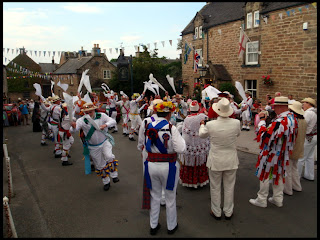
Luckily the weather was excellent and after Steve and Becca arrived and we'd had lunch, we had a wander around Main Street, which was closed from 13:30 to 17:30 for the Carnival. There were various stalls, a brass band (Ashbourne Town Band) and, of course, Morris Men dancing.
Then after having a walk around the village via the church, Oddo and the Portway track, where we bumped into Brian Woodall and his wife in his camper having sandwiches. We dropped back down past Wyns Tor and then after walking down East Bank as we approached the Old Bowling Green we watched the Morris Men for a while and had a pint in the pub.