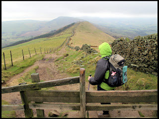
The track continued as
far as Spring House Farm from where a concreted farm track followed
uphill towards the top of Lose Hill.
The Right of Way on
the track left the track at a stile into a very muddy corner of a
field and then continued uphill to meet another footpath near
Losehill Farm which we then followed to a piece of land called Wards
Piece after crossing two more stiles.
A section of path with
rocky steps then brought us to the summit of Lose Hill where we found
a spot sheltered from the cold wind on the Edale side of the hill
just below the summit. We sat here for a short break and a coffee
from our flasks.
We then followed the
path along the Great Ridge heading towards Mam Tor. Luckily it was
clear, if a bit hazy unlike Kinder Scout and Bleaklow which largely
were covered with cloud.
We dropped down Back
Tor and arrived at Hollins Cross. Again, we dropped downhill s short
distance to find shelter from the wind and ate our lunch.
From Hollins Cross we
dropped down from the ridge on a gradually dropping path leading to
Mam Farm after the path joined a farm track for a short distance. The
path was very muddy in parts and a bit slippery.
There was a small gate
by the farm which led to another Public Footpath which we could see
on the map headed back towards Castleton. We started following a path
formed by shortened grass heading towards a farm in the distance.
Soon we realised we had gone wrong as we appeared to be on a sheep
track and arrived at a fence, although one corner was collapsed on
the ground. After studying the map for moment, we realised we had
veered off the route of the path which should be more over towards
the old road from Mam Tor near to Odins Mine.
So we retraced our
route for a short distance and soon found a small gate and well used
and muddy path which confirmed we were back on our intended path.
Near to here we were
passing what looked like an old gritstone gate post which I noticed
had an odd pattern of lines on its face. After having a closer look I
saw it was a shallow carving of a hand holding a small hammer. On
the opposite face, there was another shallow carving with a hand with
an extended index finger pointing upwards and the words “Odin Mine”
above it. So obviously this was and old Guide Stoop indicating the
route to nearby Odin Mine. The Public Right of Way we were following
was probably the old route miners would have taken from the village
of Castleton to and from the mine in years gone by.
We followed the path
across several fields along side a small brook called Odin Sitch.
Soon we walked between two high stone garden walls passing between a
couple of houses opposite Peak Cavern or “The Devils Arse” and we
joined the footpath alongside the road from Winnats Pass into
Castleton village.
 |
| Summit of Lose Hill, Mam Tor in the distance |
 |
| Back Tor |
 |
| A section of the Great Ridge |
 |
| Dropping Down from Hollins Cross |
 |
| Guide Stoop (carving of hand holding hammer) |
 |
| Other side of Guide Stoop (finger pointing way to Odin Mine) |
 |
| Close up of Guide Stoop |
 |
| Castleton |


No comments:
Post a Comment