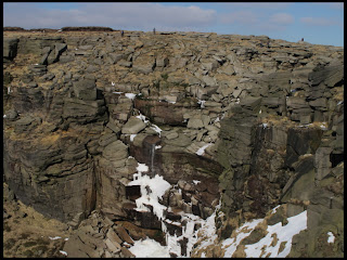
As long as you weren't in the cold wind, today was very Spring-like with the sunny, blue sky and real warmth in the sun.
We parked at the small car park near Hayfield in Bowden Bridge quarry where there is a plaque commemorating the Kinder Trespass in 1932 and set off along the minor road and across a bridge and again along a road leading past Tunstead House and then across several fields gradually-rising towards the Kinder plateau.
After going through a gate with a footpath sign, we followed a path leading to a bridleway skirting below Kinderlow End. We could hear the engine of a helicopter and looking towards Kinder we saw the source of the engine as it flew up towards the plateau with several large white sacks dangling beneath. The bridleway brought us towards Jacob's Ladder, a route down to Edale, but just after passing the ancient stone Edale Cross, we went through a gate an followed a more steeply-ascending path up Swine's Back to soon arrive at a section paved with stone flags.
We could see a nearby path coming down from Edale Rocks which was busy with walkers going up and down.
Our route curved rightwards above Edale Rocks and passed several large cairns with the white-painted trig point of Kinder Low not far away.
We continued following the path along what was the route of the Pennine Way along the western edge of Kinder heading north. As we passed some of the large plastic bags similar to the ones being brought up by the helicopter, I had a look inside and it was full of old heather plats. The bags were lying on quite a few areas of bare peat where presumably heather was being planted. Just before we reached the gully formed by Red Brook we sheltered from the wind and ate our lunch with the helicopter flying just overhead several times.
Continuing onwards, we skirted around the top of the frozen Red Brook and soon arrived at Kinder Downfall which always has small groups of walkers as it is often a destination for many walking on the plateau.
We continued onwards along the edge path until we dropped steeply down towards the junction with the Snake Path.
We followed the path leading to the left as it leaves the route of the Pennine Way and drops down towards Kinder Reservoir by following William Clough.
The path started as easy going with a rocky surface but soon degraded to a narrow and muddy path which crossed from one side of the stream to the other but soon became easier going again at a footbridge, then along a wall by the reservoir.
We saw a couple walking toward us, late middle-aged. The strange thing was that the man was in front and had a small remote-controlled car with huge rubber wheels which he was following along the path and “drove” it off the side of the path onto small rocks so that we could pass each other. It takes all sorts I suppose.
At the dam end of the reservoir we stopped for a few moments to watch the helicopter as it stopped to re-fuel and then pick up some more large bags before flying off again back to the top if Kinder.
Soon we were back on the minor road next to an old sheepwash which we followed back to our starting point at the car park.
 |
| Edale Rocks |
 |
| Edale Cross |
 |
| Trig point on Kinder Low |
 |
| Kinder Downfall |
 |
| The top of the Downfall |
 |
| Kinder Reservoir |
 |
| Descending Willam Clough |


No comments:
Post a Comment