Showing posts with label The Dales Way. Show all posts

Friday, 18 June 2010

The Dales Way - Burneside to Bowness-on-Windermere

The last day of The Dales Way and it was cool and cloudy at breakfast time which we arranged for the earlier time of 08:00 as we had to be at Bowness-on-Windermere by 16:00 for our lift back to Ilkley.
Retracing our steps to return to the Dales Way after buying sandwiches at a supermarket on the way, we were walking along the bank of the River Kent in pastures.
Soon we were at the smaller, neighbouring village of Bowston and crossing Bowston Bridge to meet the road from Burneside. Which we followed for a short way before following a jitty between houses and passing a nice housing complex next to the river, which used to be a mill.
Again walking next to the river through fields and wooded areas, we skirted past the village of Staveley. Not far after this we crossed a bridge spanning the A591 then leaving rivers behind, we were on open country and following a minor road from New Hall Farm stopping for a quick rest near the road's highest point on a convenient flat grassy area at the side of the road with views across to some of the Lakeland Fells.
After the quick rest we were on our way again following the minor road as far as a Bridleway which we followed to the left until that came to an end and the way continued in a large field via a gate.
The path continued on open ground with lovely views passing a flowing spring whose water sunk underground again after a few feet leading us past some National Park Rangers mending a farm gate next to the farm at Crag House.
Passing the gate we followed a green track to reach a minor road near the curiously-named house “Outrun Nook” and the along the road for a short distance to reach a farm track leading to the farm at Hag End. The Dales Way wends its way between the farm buildings and the owners have taken advantage of passing walkers to set up a tea shop where we stopped to have a snack, especially as we were making good time.
After our snack we continued on our way with more views on the Lakeland Fells opening ahead with a track leading us on. We reached a junction with another track coming in sharply from the left with a signpost at the junction of the two tracks. There was a “Dales Way” disc attached to the post so that it would be seen by someone coming in the opposite direction so it appeared that we should continue straight on, which is what we did. This brought us to a gate at a bend in a metalled track with “Public Footpath” signs pointing back the way we had come nut no mention of the Dales Way. Well I suppose it was obvious to just continue onwards, which is what we did until we arrived on collection of roads in a residential area. Something was wrong!
Checking the compass I realised we were heading North when we should have been heading South! Checking the map, we realised where we had gone wrong – it was at that path junction with the last “Dales Way” marker about 2/3 of a mile back. So far on the Dales Way we had hardly gone wrong at all and now on the last day we made a mistake in navigation.
So, turning around and heading back to the junction, we could see the place where a Dales Way marker had been probably showing that we should have turned left instead of continuing straight on. Now on the correct route, we saw more Dales Way markers which confirmed our suspicions.
Now there was only a short distance to go and following grassy tracks and crossing farm tracks we arrived at the large stone seat similar to the one back at the start of the Dales Way in Ilkley which said “For Those Who Walk the Dales Way” with views down and across the town of Bowness and parts of Lake Windermere. It was 14:20.
After balancing our cameras on rucksacks and taking photos of ourselves sitting on the seat, we dropped down the slope to reach a road between houses leading down into the town centre. By now the sun was out and it was again getting hot and there were throngs of tourists so the first job was to find an ice cream followed by the walk up the road to Windermere and a lift by the “Sherpa Van” people back to Karen's car in Ilkley and home.

Thursday, 17 June 2010

The Dales Way - Thwaite Farm, Howgill to Burneside (10 Miles)

 Karen in front of Thwaite Farm Farmhouse
Another sunny day and very warm. After breakfast and packing up our stuff, we left Thwaite Farm at 09:20 and dropped down through a couple of fields to a footbridge across Chapel Beck. This brought us to a path, a bit muddy in places, leading along the River Lune.
 Path by River Lune
Leaving the river bank for a track and a minor road, we arrived at Crook of Lune Bridge, another lovely old bridge, again a bit narrow for modern traffic.
 Crook of Lune Bridge
River Lune
After crossing the bridge, we followed the road as it passed beneath an arch of the Lowgill Viaduct, also a remnant of the Ingleton to Tebay line.
 Lowgill Viaduct
This led us to a larger road for a short distance then past a few houses and up a narrow grassy lane filled with wild flowers which led to open fields. Looking back we had views of the Howgills and to one side, the Lakeland peaks, the most prominent being Ill Bell. Also we could hear the noise of traffic on the busy M6 motorway only a half a mile away or so.
 Distant Lakeland Fells
The Howgill Hills
We soon crossed over the M6 on a narrow bridge joining two fields. After more fields and various farms, we reached a footbridge crossing a small beck at Grayrigg Foot Farm. It was just past Noon so we sat on one end of the bridge and ate our packed lunches.
Continuing onwards again on a mixture of tracks and fields we arrived at the small Black Moss Tarn where a family of swans and their cygnets were swimming in a lovely spot. We took advantage of the lovely location to sit and rest in the heat of the sun for half an hour.
 Black Moss Tarn
 Swan Family
As we neared Burnside, our stopping-over place for the night, we saw the town of Kendal in the valley ahead. All that remained was to pass the old mill on the River Sprint, walk through a field waving flies away, then a short section of minor road and again crossing another field to reach the road into Burneside, passing the impressive Buneside Manor and ruins (now a farmhouse) on the way.
 Burneside Manor
Arriving in Burneside at 15:30and after short rest on a bench in the shade to cool down, we bought some ice cream and cold drink in a shop and sat in a small park have them.
Luckily our accommodation for the night, The Jolly Anglers pub, was just around the corner. Although locked up and no answer to the doorbell or knocking, Karen rung them on her mobile form and we were let in.

Wednesday, 16 June 2010

The Dales Way - Dent to Thwaite Farm, Howgill (10 miles)

Leaving The Sun in Dent after breakfast, collecting packed lunches and settling the bill, we found the weather sunny and the warmest yet. We called in at the village shop first to get a few snacks and some orange squash as we had run out of the squash we had brought with us.
Dent Village
Following the route we had taken the evening before into Dent, we returned to the route of the Dales Way at the road bridge crossing the River Dee. We saw the first small plaque attached to the gatepost, part of the "Dent Network of Gates" which is an art project involving children's designs cast in gunmetal and attached to local stiles, gate and bridges.
The path followed a narrow strip next to the river with a single wire fence separating it from the hay meadow. It joined the road for a very short length then rejoined the riverside.
 Near Dent Village
Further on we saw the Dutch couple from yesterday going in the same direction as us and following the path as it veered off from the river back to the road. We passed them as they were having a rest at the side of the road and continued onwards for another mile before following a track back towards a ford crossing the river.
The ford was fairly deep and we could see a footbridge nearby and a worn bit on the riverbank where others had clambered up and through a gap in the hedge to a path leading to the bridge. Obviously we had missed the other end of the path by the ford.
Anyway, we crossed the footbridge and saw a man and a lad checking their Dales Way guidebook before moving on. Karen and I sat on the footbridge steps for a few minutes to have a drink and saw the Dutch couple at the ford also looking for the way to the footbridge.
Continuing onwards, we followed an enclosed footpath and crossed the main road to the continuing path on the other side by an ornate gate into a large garden belonging to Gate Manor, then followed the path as it followed the Manor's garden wall and steadily gained height with views down the dale back towards Dent.
The path now continued across pastureland eventually reaching a rough track leading to the tiny village of Millthrop. Taking a road to the left we reached the main road again and a bridge crossing the River Rawthey. From here the Dales Way takes a footpath not far from the bridge. We were only 3/4 of a mile form the town of Sedbergh so we decided to continue along the road and find a tea shop. Despite it being midday, we weren't very hungry so just had a fruit scone and raspberry jam each.
 Millthrop Village
As it was so warm, we also got an ice cream from a nearby news agents and after a quick trip to an ATM, followed the main street for a few yards then on a Public Right of Way passing Sedbergh School and its cricket ground and other sports ground leading us back to the Dales Way at Birks.
This meant missing about half a mile of the official route, but our route was about twice that and also meant having the delights of Sedbergh which we would have otherwise missed out on!
 Sedbergh
 Sedbergh
From Birks we followed a minor road for a quarter of a mile then back on a footpath next to the river. At an old mill building (still in use for some other business), we passed a footbridge leading to Catholes and stayed on the same side of the river following an enclosed path from the mill building's car park.
After a short distance we were in open field again and stopped for a few minutes beneath an old viaduct belonging to a disused railway which we had just crossed. The central portion of the viaduct is made from wrought iron and has several arches in a complicated arrangement as they are side-by-side but the stone parapets which they bridge do not have parallel faces and are at an angle to each other. Quite amazing really.
Again we ended up on a main road for half a mile then back into pasture and through the hamlet of High Oaks. After following a track we reached a junction of footpaths with one leading straight on toward Killington New Bridge and the other to the right to Lincoln's Inn Bridge, which was our way.
We stopped here in a large field next to a hedgerow and took our boots of f to let our feet cool down a bit. Soon Karen spotted a fox coming through a wire fence from the field next door. The fox spotted us, about 30 yards away, and while keeping an eye on us, trotted past only to disappear behind a clump of long grass and not to appear again. Presumably it had gone down a hole.
With our rest over, we replaced our boots and continued on our way. We reached Lincoln's Inn Bridge which is a narrow road bridge which spans the River Lune and which was unfortunately slightly damaged at one end due to a vehicle accident.
The path rose to cross the road crossing the bridge and almost on the opposite side we continued on a track leading to the footpath now beside the River Lune.
Shortly after this we came upon the impressive Lune Viaduct constructed out of red sandstone with a metal section spanning two massive central piers. This viaduct was for the same disused railway (the Ingleton to Tebay line) as the viaduct we had seen earlier. We passed underneath one of the huge arches and then followed a path gradually rising upwards on steeper ground to the right.
This brought us to a gate and a stile and a path leading to Bramaskaw Farm. As we approached the farm, a cockerel came running down the field past us then mounted a nearby hen and started mating!
From here the route wasn't obvious but the farmer had painted large "FP" signs here and there leading past a small stone-built barn with short adjoining drystone walls until we arrived at a gated track.
The track led us to Hole House Farm and then to a large field with a bend of the River Lune flowing past. The problem as that our accommodation for the night, Thwaite Farm, was some distance away above the sloping ground with no path leading to it from this direction. Also there were a number of men working on power lines crossing the field below the farm.
We found our way through a gate into the farmyard and found the owner, Mrs. Parker. As the adjoining holiday cottage was unoccupied she said we could stay there for B&B and showed us in. It's a very lovely two bedroom cottage recently refurbished with amazing views. At first the power was off, due to the work we had seen the men carrying out on the power lines but it was due to be back on at 17:30 and it was now 16:30 so that was no problem.
As we still had our packed lunches, plus a couple of sausage rolls we also bought in Sedbergh, we had these for an evening meal. Otherwise we had planned to ask Mrs. Parker for a lift into Sedbergh for a pub meal, which she would have been happy to do.

Tuesday, 15 June 2010

The Dales Way - Station Inn, Ribblehead to Dent (10 miles)

After breakfast at the Station Inn we set off at 09:30 on a lovely, sunny day which wasn't too warm and very pleasant.
First we had to retrace our route back the mile and a half or so along the road to rejoin the Dales Way. We had been eating breakfast with three other groups of two who were also walking the Dales Way and were staying at the Station Inn.
 Ribblehead Viaduct with Whernside Behind
We rejoined the Dales Way which flowed a farm track past two farmhouses, then uphill and around the back of one of them with increasing views back towards Ingleborough and also Pen-y-Ghent.
The route crossed a couple of miles of typical gritstone moorland with the song of skylarks and curlews accompanying us with fields of buttercups and other wild flowers.
 Fields of Buttercups

 Wild Flowers
We reached a minor road which went downhill to pass beneath one of the arches of Dent Head Viaduct which like the one at Ribblehead, carries the Settle - Carlisle Railway. Dent Head Viaduct is in a more picturesque setting in a small valley with some trees and pastureland. There is also an ancient packhorse bridge beneath the highest arch.
 Dent Head Viaduct

 Ancient Pack Horse Bridge beneath the Viaduct
We walked along the quiet minor road for a few miles with the River Dee alongside, which was mostly flat limestone bedding with very little or no water at all. We were now in Dentdale which is mostly pastureland with fields and fields of hay meadows full of a variety of wild flowers. These are mainly buttercups so the meadows are an ocean of bright yellow.
 Karen and Chicken
We sat on a bridge parapet by Stonehouse Farm while Karen had a sandwich and were accompanied by a hen hoping for a free feed!
While we were waiting there, an older couple, who we had seen at the Station Inn, came walking past. We were to leapfrog each other on our way to Dent as rest stops were made.
 Lunch stop
Continuing on our way, we finally were back off the road and into pastureland until we reached a road bridge. Another stretch of quiet minor road followed, thankfully a lot shorter, leading to a recently felled wood. We stopped in the shade of some trees just before this wood with wise views back along the way we had come and had our lunch keeping an eye out for any more irate farmers but yesterday's incident proved to be a one-off.
After lunch we crossed the area of stumps of felled trees, already planted with a mixture of saplings to regenerate the wood, and then followed a series of meadows interspersed with short sections of farm tracks until we arrived back on the minor road once more.
 Dead Moles on a gate. Left by the Mole Catcher to show the Farmer he had done his work!
We were only supposed to walk along a short stretch of road and then follow a footpath to the right which should have brought us to a ravine called Lenny's Leap which has a usually dry resurgence cave but didn't see any signs and up to this point the route had been well sign-posted.
Thinking we must have missed the footpath as we had been on the road for a lot longer than expected, we saw one of the couples of walkers from the Station Inn walking towards us and at the same time spotted a footpath sign pointing to the right.
The couple, who sounded Dutch, told us that we had missed the earlier footpath but this one would get us to the same place a little further along the Dales Way. The sign said it was the way to Tommy Bridge. The correct footpath would have taken us to Lenny's Leap and then across the River Dee by Nelly's Bridge. The route would then have followed the opposite side of the river for about a third of a mile to re-cross the river by using Tommy Bridge. So, in effect we hadn't made the route any shorter or longer, just a bit longer on the road than necessary.
 Hay Making
Looking on the map, we had almost reached Whernside Manor which used to be a caving centre at one time. As we started down the footpath to Tommy Bridge, we heard the Dutch couple telling the other older couple who were just behind us about missing the correct path as well. The footpath sign for the path to Lenny's leap must either either be missing or well hidden.
On reaching Tommy Bridge we stayed on the same side of the river and followed the footpath signs across a large field away from the Dee and then downhill to a road and a bridge crossing Deepdale Beck.
A hundred yards down this minor road brought us to a footpath sign and a worn path along field edges next to the Beck. Again, the water appeared and disappeared. Soon we came the the confluence with the Dee where there was a large stagnant-looking pool with loads of small fish which were swimming around and crowding like hungry piranha around any insects landing on the water.
Just there the gap between the field fence and the river was wider than it had been and the two of us sat for a few minutes on the riverbank which was about 10 foot high and faced with drystone walling just above the pool. Karen was dropping pieces of bread from her remaining half a sandwich and giggling as the hungry fish swarmed around each piece and grabbed it. As we were doing this, the older couple passed us again on their way to Dent where they were hoping to get some soup at a tea shop before continuing onwards to their stopover place at Sedbergh.
 Cobbled Street in Dent Village
We finished feeding the fish and shouldered our rucksacks for the last little bit to Dent, arriving at the Sun Inn at 15:45. Joy of joys, it had a sign outside proclaiming a “Football Free Pub”. So we would be spared yet more World Cup television!
 The Sun Inn, Dent

Dent Church

Monday, 14 June 2010

The Dales Way - Swarthghyll Farm to Station Inn, Ribblehead (6 Miles)

Because of the availability of accommodation within a reasonable distance for a day's walk, we booked a night at The Station Inn at Ribblehead right next to the historic Viaduct carrying the Settle-Carlisle Railway. So today would be a short day.
So, after cooking our breakfast and collecting sandwiches as ordered for lunch, we set of at around 10:00 with a cloudy sky heading towards the neighbouring farm of Cam Houses. It looked like it might rain so I was wearing my Rab Bergen jacket. The ground as a bit soft and boggy in places so I wore my gaiters for the first time on this trip instead of carrying them in my rucksack.
Karen disturbed a Snipe which was in the grass next to the footpath and it took off and flew around. We then spotted two young chicks left on the ground, so we hurried on so as not to disturb them. We also had our first glimpse of Ingleborough, one of the “Three Peaks” in the Yorkshire Dales, in the distance.
 Ingleborough in the Distance
Just as we got to Cam Houses, it started to drizzle. Just as we found a sheltered spot under some trees near the farm, the drizzle turned to light rain and we waited for a short while to see if it would stop.
The rain eased off and we started walking once again. Very soon it started to rain lightly again, so we stopped again and got our waterproof overtrousers on.
We continued onwards, cutting through the corner of a pine wood, across a farm track then up a short steep section to meet the Pennine Way at a set of signposts and a cairn. Karen had received a mobile phone signal and got a text message from Keith saying he and Pete had another breakthrough in Water Icicle Close Cavern and had progressed another 100 metres with easy digging continuing!
 Dales Way and Pennine Way together
We followed a wide track which is on the route of an old Roman road from Ingleton which is also shared with the Pennine Way for a short distance. We realised it was past Noon so stopped at some boulders near where the track joined a minor road. As it had stopped raining, we sat with our backs to a boulder which sheltered us from the bit of wind that was blowing.
Just as we had finished eating, the farmer drove by on a quad bike on the track yelling "Oi, keep to the footpath! That land is private!". We packed up as were on our way anyway.
We walked along the minor road mostly on the open grassy verge heading toward Chapel-le-Dale and Ingleton, passing the continuation of the Dales Way as the Station Inn is a mile and a bit off the route. At the junction with the road to Horton-in-Ribblesdale, we bought an ice cream from the burger van that usually parks there and ate them while sitting on a bridge parapet watching a group of cavers getting ready to have a trip in one of the many caves on Blea Moss.
 Ribblehead Viaduct
After the ice creams, at about 14:00, we entered the Station Inn and dropped our stuff off in our room then went for a short wander around the area by the Viaduct looking at cave openings and limestone features.
 Station Inn, Ribblehead

Weather Forecasting Stone on the Station Inn

Karen and one of the nearby caves

Another view of Ribblehead Viaduct

Sunday, 13 June 2010

The Dales Way - Kettlewell to Swarthghyll Farm, Oughtershaw (12 Miles)

After breakfast at the Youth Hostel at 08:30, we packed up and waited outside the village shop at 09:10 for it to open at 09:15. Soon a few others also joined in looking to buy their Sunday morning papers, etc.
Having bought two freshly-made cheese and pickle sandwiches and other snacks, we were on our way again. There had been some rain overnight and the morning was cool and overcast so I started off wearing my Paramo Fuera smock.

After crossing the bridge at the Western end of the village, we were once again following alongside the River Wharfe through fields and pastures full of with flowers: mostly buttercups and clover. After a couple of miles we passed a bridge across the river to the village of Starbotton and were listening to the loud cries of curlew.
 Sand Martin burrows in river bank
After the same distance again, we took the small detour across a road bridge to the village of Buckden to have a pot of tea or hot chocolate and some ginger cake. We had been here before while on a caving trip to Birks Fell Pot so it was familiar countryside.
Re-crossing the bridge, we were back in fields and pasture land on the bank of the river. Half a mile later we passed through the hamlet of Hubberholme with a pub and a lovely old church with a Norman tower.

Hubberholme Chuch
At the next set of farm buildings at Yockenthwaite, we crossed a bridge to the road and on checking the map realised we had gone wrong as we should have stayed on the other side of the river. Re-crossing the bridge, it began to drizzle again which it had been doing off and on for while.
Yockenthwaite Stone Circle
We stopped at Yockenthwaite Stone Circle which is about 20 feet across and made of about 30 small boulders. A bit further along, at 13:45 we stopped for lunch.
Half an hour later we were on our way again. We arrived at Deepdale and again crossed the river by road bridge. This was where we had parked on a caving trip to Hagg Gill Pot a few years ago.
The drizzle started again and soon worsened to light rain. We sheltered under a hawthorn tree and I replaced the Paramo smock with a Rab Bergen jacket and we both put on waterproof trousers.
Continuing onwards along the river which varied in water flow as water sunk and reappeared, we crossed a footbridge and passed the farm buildings of Beckermonds. where unfortunately not only did we leave the side of the river, but we had to walk on the road for over a mile. Luckily it is a quiet road with very little traffic.
We passed the very nice building of Oughtershaw Hall now with light rain again. Soon we saw a sign pointing along a farm track to Nethergill Farm and also our accommodation for the night, Swarthghyll Farm.
Swarthghyll Farm
After passing Nethergill Farm, we could see a farm in the distance. Surely, we though that couldn't be Swarthghyll Farm - it looks much too far away! Looking at the map confirmed it was the right direction. Luckily, after passing a rise in the track we saw Swarthghyll Farm a few hundred feet away.
 Our accommodation for the night with the brown door
We arrived at 17:45 and found a door in the farmyard with a notice and Karen's surname. We opened the door to our single bedroom flat for the night. The arrangement was that an evening meal and breakfast would be ordered and the food would be left for us to cook ourselves. So we had a very nice Cottage Pie and then watched the television until after 23:00 and then went to bed.

Saturday, 12 June 2010

The Dales Way - Appletreewick to Kettlewell (11 1/2 miles)

After an excellent Full English Breakfast at the pub at 09:00 we settled up our bill and arranged to leave our bag in the bar so that the “Sherpa Van” service could collect it later and deliver it to Kettlewell Youth Hostel. We were away at 09:30 and walked about a quarter of a mile down the road on another sunny day which was breezy and not too warm. Following an an enclosed path past a very large and busy camp site, we were soon once again walking along a footpath running alongside the river Wharfe.
 New Inn, Appletreewick
Soon we reached the bridge across the river at the lovely village of Burnsall. There was a Tea Shop busy with cyclists and next door a village shop. I bought some orange juice and some fudge and Karen also bought a snack and we sat on a bench overlooking a large green area next to the bridge as ducks waddled over to see if they were in luck and could cadge any food off us.
Burnsall Bridge
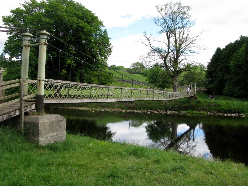
After our quick snack we crossed over the road from the bridge and followed a path past the Red Lion pub next to the river. We passed a couple of fishermen and arrived at a narrow pedestrian suspension bridge crossing to the opposite side of the river. After following along the river bank and across a large pasture, which missed a loop in the river, we saw some houses on the opposite river bank with a footbridge crossing over.
Suspension Foot Bridge
This was the small village of Linton Falls. The Falls themselves are not very large and were below the far side of the bridge. We saw on the map that there was a Public Toilet nearby, so we decided to make use of the facilities.
 Linton Falls
Afterwards we retraced our steps and re-crossed the bridge. Continuing along wide river bank we arrived at Grassington Bridge which is built of stone and carries a busy road.
 No Camping Allowed!
We crossed the road which crosses the bridge and then followed the roadside footpath for a short distance into the quite large village of Grassington and were soon in the lovely Market Square. This was quite crowded as the Bradford Grammar School Big Band were giving an open air concert. We went into a nearby Tea Shop and had a pot of tea and toasted tea cake. Karen returned to the Market Square to get some cash from an ATM.
 Market Square, Grassington
Walking uphill past the old Town Hall, we followed a small road and then along a lane to fields. We had left the river Wharfe for open limestone country with their network of drystone walls.
Following a well-marked route we arrived at a large lime kiln and decided stop for lunch which would be sandwiches we had bought earlier in Grassington.
 Lime Kiln
After our stop we continue on our way along the Dales Way, pausing to look at Conistone Dib, which is a dry valley with interesting limestone outcrops and features.
Continuing again listening to the curlews and skylarks; mainly curlews but with a few skylarks and also a few lapwings we clambered up and stood on top of Conistone Pie, which is a natural limestone feature but looks like a tower form the distance. From here were lovely views to the Littondale junction with Wharfedale with Kettlewell in the distance and the imposing Kilnsey Crag opposite.
 Conistone Pie
We followed along wide grass-covered limestone bench beneath a limestone escarpment to arrive at a gate in corner of a wood leading onto a steeply-descending track dropping onto the road to Kettlewell. After following the quiet road for a while, we passed through a gate and numerous fields with some gates and some stiles to eventually arrive at a narrow path leading past some houses into Kettlewell village centre.
 Kettlewell Roof Tops
We soon found Kettlewell Youth Hostel, arriving at 17:40.We booked in and ordered an evening meal and the went upstairs to a 5 bed room to ourselves.
After a shower and changing into clean clothes, we sat in the Lounge for a while then went to the Dining Room for our meals. Afterwards we had a walk around the village and had a quick drink to ourselves in the King Head down the road, again quite busy with customer watching England play USA in the World Cup.