Friday 31 May 2013

Doolin River Cave

A cloudy but dry start to the day, with a little drizzle overnight. Boyd, Keith and I walked down to Fisherstreet Pot, which has a new fence with a small gate around it replacing the old damaged fence that was there on our last visit. Again, someone seems to have been busy tidying up various cave entrances in County Clare.
We tied a 30 metre rope to the new gate post backed up to the nearby electricity pole with a spare 10 metre rope. Keith had brought an oversuit and wellies so he did the rigging job. Meanwhile a small heard of bullocks in the same field came thundering down the sloping pasture to find out what was going on and then took to licking the rope.
We set off back to the cottages and then later in the day we all had a lift in Boyd's van, dressed in our caving gear, up the road to the gates leading to the farm where one of the other entrances to Doolin River Cave, that is, St Catherine's Cave, is located.
As on previous trips we knocked on the door to ask permission to enter St Catherine's Cave, but as usually happened before, there was no answer. At least we tried!
We had an excellent trip as usual in the excellent cave, mostly following the underground river which was never more than a foot or so deep. Still, it was sobering to spot the odd plastic bag caught in the roof some 30 foot above our heads, left high and dry during times of high-water...
We had entered St Catherine's at 11:45 and were all back on the surface at Fisherstreet Pot at 14:05.
Afterwards we de-rigged our rope from Fisherstreet Pot and walked back in our caving gear to Doolin Cottages much to the amusement of tourists sitting outside McGann's pub.
After showers and washing caving gear we drove down the road to stop at a café near the Tourist Information Centre to have a pizza seeing a it had “Pizzeria” as well as “Cafe” on its shop sign. We were told by the staff that they only did pizzas on Saturdays and Sundays after June!

Oh well, so it was back to Lisdoonvarna to get fresh baguettes for lunch.


Thursday 30 May 2013

Cullaun 1

Boyd and Jenny shot off at 10:00 to go dolphin watching. We left the house at 11:00 to have a trip in Cullaun 1. As we had already located the entrance before going in Cullaun 2 the other day, we went straight to the entrance.
The entrance is a 4 metre climb down which is fairly easy but doesn't look like it when looking down the route from the surface, so we had rigged a handline to a nearby tree to offer a bit of assistance.
At a low wet hands and knees crawl on a scalloped floor with sections having the same height as the length of my thigh bones which is very annoying.
I soon got fed up with this and my knees were complaining so I decided to stop there while Karen and Keith carried on. I waited by the start of the crawl for about 20 minutes and then at 14:00 headed back towards the entrance as I was getting a bit cold.
When I had passed an obstructing block in the narrow meandering passage near the entrance, I heard the other two coming behind me so I waited for them.
We then continued to the entrance and I climbed out while Karen and Keith continued following the meandering passage passing this entrance for a short distance and they appeared on the surface close by after having come out of an alternative entrance.
We returned to the car and got changed, then set off for Lisdoonvarna to buy lunch and then retuned to Doolin to eat lunch and hang up our wet caving gear in the garden.

In the evening we ate a meal in McDermott's then returned to the cottages and later on spent some time in another very nearby pub, McGanns.

Wednesday 29 May 2013

An Active Day

Today started warmer although cloudy to start with little wind. In the morning after breakfast we read for a while then walked down to the new café near O'Connors pub for coffee and chocolate cke and then a short wander around the small shops there.
In the meantime, the clouds had dispersed, the sun was out and it was around 19 degrees C. We spent a short time walking on the limestone bedding on the beach by the harbour then had an ice cream by the pier as the “Happy Hooker” set off with a group of tourists heading for the Arran Islands just off the coast.
We walked back to Doolin Cottages and again read for a while before driving to Ennistymon to get more cash from one of the ATMs there and also buy a little food in Lisdoonvarna on the way back.

We then spent the rest of a very active day reading and doing some laundry.

Boyd and Jenny had gone for the day driving and visiting places in the Burren.


Tuesday 28 May 2013

Cullaun 2

Boyd joined us again and Jenny read in the van. First Karen, Keith and I found the entrance to Cullaun 1 using a photocopied and laminated page from “Selected Caves of Britain and Ireland” which has and accurate description of the route to the cave. This was so we could have a trip to Cullaun 1later in the week.
Then the four of us had a very pleasant trip in Cullaun 2 for nearly 2 hours. We went as far as the wet climb down to near the sump at the end of the cave.
I had forgotten how well decorated the cave is in some parts with some stunning white formations, although the most well known formation, the “Bloody Guts” which is so called due to the dark red colouring, is no longer what it once was.

Before this trip the three of us had coffee and cake in the Doolin café which is near MsDermotts and was a nice café. The café was closed down on our previous trips to County Clare and has re-opened recently.

Saturday 25 May 2013

Caving in County Clare

It was an early start from Winster as Karen, Keith and I left in my car to travel across to Ireland for a week's caving holiday in County Clare.
After a good and smooth crossing from Hollyhead to Dun Laoughaire we arrived at our usual accommodation of Doolin Cottages in the afternoon to find Jenny and Boyd Potts already there. They had been in Scotland for some time and had travelled to Doolin via Northern Ireland and had spent the last couple of days travelling around.

The first thing the three of us did was a quick trip to McDermotts pub at the end of the road to have an Irish Stew and then listen to the music later on and drink some Guinness!

Sunday 19 May 2013

The Great Ridge, Lose Hill to Mam Tor

What a difference in the weather! It was cloudy with sunny spells and very humid and a lot warmer. I had planned on a traverse of part of the Great Ridge which separates the Hope and Edale valleys.
After parking up in the layby close to the cave known as Windy Knoll below Mam Tor, I got my boots on and wearing only a thermal shirt, set off on the path which leads from the gate on the layby heading towards Winnats Farm at the top of Winnats Pass.
As I crossed the fields behind the farm buildings, I found a ewe and her two lambs with the ewe laying with her feet point upslope and she was bleating. It was obvious she had got herself “cast” where because of the slope and the position she was lying, she was unable to get to her feet.
I grabbed one of her hind legs and pulled her around so that her back was now upslope and she started bucking her legs to try and stand up. Sometimes a ewe will get “cast” and then exhaust herself thrashing around trying to regain her feet, but this ewe was obviously not at all tired, mush less exhausted, and as I gave here a helpful shove on her back, she was soon back on her feet.
She walked a few metres away and returned to the business of grazing while here lambs joined in.
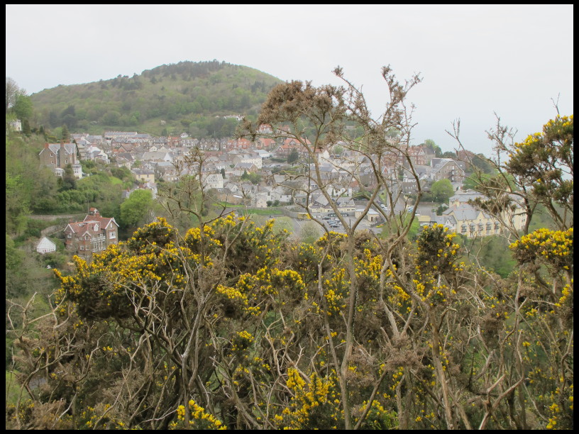
I followed the path through the Blue John Cavern car park and out the other side to a narrow path contouring the slope above Odin Mine and Cave to arrive at Treak Cliff Cavern, which is another show cave like Blue John Cavern, where the rare Blue John stone was once mined.
After dropping down the concrete path belonging to Treak Cliff Cavern to reach the Castleton Road, I followed the roadside path for a few hundred metres until I was at a stile leading to a short path across grass to Speedwell Cavern, at the foot of Winnats Pass.
Next was the public footpath leading alongside a field wall below a large sweep of sloping pasture which brings you to a field gate and then onto a road in Castleton village near the Peak Cavern (or as they prefer to be know nowadays by the older name of The Devil's Arse!).
The road leads to the village centre at the old Market Square where the Castleton Youth Hostel was until it was sold and a new one opened at Losehill Hall further up the road towards Hope.
I succumbed to temptation and had an ice cream which I ate while perched on one of the stone sections surrounding the village war memorial, after which I stopped at one of the village shops to buy a sausage roll for lunch.
I followed the road leading out of the village centre towards the Hollowford Outdoor Centre and then along a vehicle track passing behind the new Youth Hostel at Losehill Hall until I was at a public footpath leading upwards across fields. The signpost was rotten but you could just make out “ose Hil” of Lose Hill, where the path was leading to.
After a gradually-rising path passing more ewes and lambs, I joined a path leading up to Lose Hill we had followed some time ago, from Hope train station. There was a group of you girl back-packers, presumably on a “Duke of Edinburgh” week-end, also heading towards the top of Lose Hill.
Soon I was walking up the rough rocky steps near the top of Lose Hill and then passing the busy summit, I found a small grassy hollow out of the wind overlooking the Edale valley, where I stopped for a quick snack.
Continuing along the Great Ridge, I crossed Back Tor and Hollins Cross and then beneath the paragliders as I walked up towards the highest point: the summit of Mam Tor. As this summit is only a short and easy walk from a car park it is usually very busy, especially when the weather is good, as it was today.

I dropped down from the summit of Mam Tor to the road at Mam Nick and then down the sloping field back to my starting point.


Saturday 18 May 2013

Kinder Scout

Up via Grindslow Knoll, down Ringing Roger. I parked at the usual layby in Upper Booth and after having a quick look around to see if there was any sign of my walking poles which I had left on my car's roof a fortnight ago (not surprisingly, there was no sign of them), I set of along the road which eventually leads to Jacob's Ladder and then followed the public footpath which starts at Upper Booth farm across to Grindsbrook Booth (Edale village).
By the junction with the path leading to the Old Nags Head, I turned left headed for the top of Grindslow Knoll.
It had been foggy in parts as I drove towards Edale but the valley bottom was clear. As I ascended Geindslow Knoll, I reached the mist and fog which was covering the top section of Kinder Scout and from then onwards I was engulfed in the mist.
Its always surprising when there is a strong wind and it is still misty, as it was today, but I suppose that just shows how much mist there is as it is probably being blown along quickly by the wind.
At the top of the popular route up Grindsbrook Clough, I paused in the lee of some rocks to have a quick drink of water and then continued onwards on the path along the edge heading eastwards with the strong wind either behind me or from one side.
A I reached the top of the invisible rocky ridge of Ringing Roger, I crossed the stile in the fence and made my way across the flat area leading to the start of the ridge as it descends to Grindsbrook Booth.
I sat on a small alcove formed in the gritstone ridge out of the wind to have a snack and then dropped down carefully to the path below. For some reason the wind was at its strongest as it blew past the ridge.

Soon I was in the sheltered and mist-free village of Grindbrook Booth and I followed the start of the Pennine Way near the Old Nags Head inn to the path junction I had reached earlier and then retraced my route back to the starting place.


Sunday 12 May 2013

Porlock

After breakfast and packing up at the hotel, we drove to Porlock where we had a wander around and ate lunch in a small café before setting off for our respective homes.

Saturday 11 May 2013

Dunkery Beacon from Horner

Today involved a short drive for Karen, Keith and myself tot he village of Horner where we parked in the car park.
We followed a track through Horner Wood where we noticed a lot of the trees were damaged with broken, twisted boughs, or fallen over altogether. We couldn't work out whether this was due to strong winds or due to heavy snow and ice from last winter.
We reached a point where there was no obvious path so we continued in what we thought was the right direction and as we were following the side of a small valley, we spotted around a dozen Red Deer hinds watching us from above.
As we approached Lang Combe, there was a short shower and near the minor road which Lang Combe brought is to, we made use of a small hollow which was sheltered from the wind to eat the sandwiches which we had bought earlier in Lynmouth before setting off.
After our lunch stop we crossed the road and then followed a track passing the Bronze Age tumuli of Great and Little Rowbarrow.
There was quite a wind blowing as we continued on the track to reach the large stone cairn marking Dunkery Beacon. Here we sheltered in a small grassy hollow and checked the map to decide on our return route to Horner.
We chose a path heading north which soon brought us to the East Water valley and the path along the East Water which crossed alternately from one side of the river to the other side and back again.
We left the river side path at a sign marking Windsor Walk and then continued along this oath through the woods back to our starting point at Horner where we had coffee and some cake at a house which sold refreshments and had tables and seats in a large garden.
Later in the evening we returned to the Crown Hotel pub in Lynton for a meal.


Friday 10 May 2013

The Cleaves

Luckily the weather was much better today, even if it was a bit cool. It was Karen;s 50th birthday (we discovered that she shared the same birthday with the owner of the North Cliff Hotel, whose name is Kate) and she opened her birthday cards and presents after breakfast in the dining room. The three of us: Karen, Keith and myself, set off after breakfast and left the hotel to follow the road out of Lynton which heads for Barbrook and then crossed the river via a bridge beside a pub which is marked as “Lyn Bridge” on the O.S. Map.
On the far side of the bridge, there was a path and we turned left to follow a route which took us back along the river on a rising path which soon offered viewpoints across and down to Lynton and Lynmouth below.
The path followed above the Lyn basically following much the same as yesterday but at a much higher level with views across to the other side of the Lyn valley and also the large valley continuing on past Watersmeet.
Eventually we dropped down a zig-zag path and after passing the site of an Iron Age settlement, we arrived at the road near Hillsford Bridge.
We had a second visit to Watersmeet House by following the riverside path from Hillsford Bridge and had our lunch stop their. Karen took a fancy to a bronze hare on sale there and decided to come back while in the car and buy the bronze hare rather than buy it now and have to carry it in her rucksack.
Continuing back along the East Lyn river from Watersmeet as far as Rockford, we the followed a rising path which tool us to some fields with a few horses including one particular one which was very interested in us.
The path brought us past Wilsham Farm to join a bridleway continuing north and around he head of a small valley then upwards to arrive at the A39 road near Countisbury and the small car park of Barna Barrow.
We crossed the road and then walked through the small car park and followed a path through gorse bushes which skirted near the small church at Countisbury before dropping down some steps onto the South Coast Path which followed around the steep ground above the sea shore and after reaching the side of the A39 again in a layby, it followed behind a low wall and then left the road to zig-zag down to the seashore near Lynmouth.
We found Pat and Bob nearby chatting to a man in the refreshment kiosk at the crazy golf course who it turned out to be was the previous owner of the North Cliff Hotel when the Slatcher family used to have family holidays in the area years ago.
Later on we all drove from the hotel down a short way into Lynmouth, planning on a meal at the really nice Rising Sun pub but it turned out to be packed with people even though it was only 18:00.
So we went to another nearby hotel to eat instead.


Thursday 9 May 2013

A Few Days in Exmoor

Karen and I travelled down to Lynmouth from our home in Derbyshire while Keith left Rugby with their parents Pat and Bob.
We had arranged to meet in the car park in Lynmouth and funnily enough arrived within seven minutes of each other at 12:30!
It had been raining as we approached the end of the journey and in Lynmouth there was quite a lot of rain. We decided to have lunch first at a chip shop and afterwards dropped our stuff off at the North Hotel in nearby Lynton, where we were staying.
Returning to Lynmouth, Karen, Keith and myself walked along the East Lyn river to Watersmeet while Pat and Bob had a wander around the village.
We bought a snack and hot drinks at the National Trust property at Watersmeet House and sat on the surrounding verandah sheltering from the rain while we had our drinks and food.
We returned back to Lynmouth following the same route. Later in the evening we had a meal in the pub at the Crown Hotel.


Monday 6 May 2013

Aquamole Pot

Today was supposed to be the best weather-wise and so it proved to be. Ingleton and afterwards, Kingsdale, seemed very quiet for a Bank Holiday Monday. After breakfast we drove to Kingsdale and after parking in one of the laybys and getting changed we walked up the slopes to the Turbary Road (an old track which was used to access arear where peat cutting used to be carried out. We soon found our cave, Aquamole Pot, after a slight detour as we turned right at the Turbary track and arrived at Bull Pot instead of left towards Jingling Pot and then nearby found the lidded shaft of Aquamole Pot.
Soon Keith was abseiling down the short breeze block lined entrance shaft followed by Karen and lastly myself. I had the job of sliding the grid cover back over the shaft entrance to prevent the odd sheep joining us underground.
What a brilliant cave!
We continued down several more pitches rigging our rope next to those already in place, which had been left by cave divers who are still exploring the sump at the bottom of the pot.
We reached a short and slightly awkward crawl (when you have a tackle bag) at the bottom of one pitch and I elected to wait there as the others continued. My injured left arm was still twinging and I decided to take it easy to avoid further injury as we were going caving for a week in County Clare at the end of the month and I didn't want to have an injured arm again this time.
Karen and Keith returned just over an hour an a quarter later raving about how good the rest of the cave was, especially the largest pitch. I spent most of the time setting up the replacement SRT footloop and safety-link whcih I had bought in Inglesport yesterday to replace my old worn-out ones.
I took the tackle bag Karen was carrying and headed back up the pitches to the surface to find the sun was out and the day had turned into a lovely spring day in the Yorkshire Dales.
After changing, we said good-bye to Keith as he set off for home while Karen and I had a meal in Bernies before setting off for home ourselves.

Sunday 5 May 2013

Tatham Wife Hole (was the plan!)

Another damp start with light rain and after breakfast at Bernies, Karen, Keith and I parked in the layby opposite Beesley Farm on the Ingleton to Ribblehead road.
We changed into caving gear and started the steep approach to the plateau below Ingleborough where our target for the day, Tatham Wife Hole, is found.
Unfortunately it was very misty as well as drizzly and we could not locate the cave entrance despite a good search around.
So after a two hour walk, we returned to the car and got changed again. Rats.
We consoled ourselves in Bernies with a brew and snack.

Saturday 4 May 2013

Rowten Pot

Spring Bank Holiday and as no one was going on the Orpheus CC trip to South Wales, Karen, Keith and I decided on a caving trip to the Yorkshire Dales.
As it was a late decision, we were lucky to get accommodation at the Old Schoolhouse in Helwith Bridge, which belongs to the Yorkshire Speleological Society.
As always, Karen and I travelled up last night on the Friday and we met Roy Rogers, who is a YSS member, already at the Old Schoolhouse. We had arranger with him to join us for a trip underground today as he had only the one day free for the weekend.
Breakfast was at the usual location of Bernies in Ingleton, where we were relatively early and met Keith at just after 09:30. We had gotten up from bed a bit earlier than usual as a group of “more mature” members of a mountaineering club were also staying at the Old Schoolhouse and some of them were up and banging about at 6:00!
Anyway, it was damp and drizzly, as forecasted, along with some light rain overnight. We all wanted to have a trip down Diccan Pot and accordingly drove to the track of Alum Pot Lane at Selside to get ready for the trip.
We realised that the light rain and drizzle was showing no signs of dissipating, which it was supposed to as predicted by the weather forecast. So, we decided on a change of plan and headed to Kingsdale where we parked in a layby convenient for Rowten Pot.
We had noticed that beyond the resurgence at Keld Head, Kingsdale Beck was dry, as it would usually be when the weather is dry or there is a small amount of rain, but we were surprised to see water in the beck further along the valley towards Dent.
After changing into caving gear, as we were walking up the valley side, I was surprised to see that the beck was now flowing well with water and had gone way past us and was already past the bridge leading to Braida Garth farm!
Anyway, Keith set off down the open pot of Rowten Pot followed by the others with me bringing up the rear as I had the tackle bag containing the rope for the final pitch. My left arm had been a bit painful around the inside of the elbow joint recently and as I was trying to unclip my cowstail from the rebelay a short way down, I pulled something in it which made it feel worse.
I joined Roy on the muddy ledge below and after passing him the tackle bag I was carrying (he had already passed his onwards to Karen), I decided to wait there for the others to return as I didn't want to risk injuring my arm and spoil the forthcoming trip to County Clare at the end of the month.
I had a wander around looking at this bit of Rowten Pot and not too long afterwards I could hear the others making their way back up over the roar of the water below.
I grabbed the tackle bag Roy was carrying and headed back to the surface. We wee all back together in the much drier weather after 3 and a half hours underground with everyone else having reached the bottom of the pot.
After getting changed out of caving gear, we returned to Bernies for chip butties and then back to the Old Schoolhouse. We spent the evening in the pub opposite, The Helwith Bridge, which had had new owners since the previous owner, Colin, retired. I'm glad to say it hasn't changed a bit and the beer and pizzas are as good as they always were.