Sunday, 13 June 2010

The Dales Way - Kettlewell to Swarthghyll Farm, Oughtershaw (12 Miles)

After breakfast at the Youth Hostel at 08:30, we packed up and waited outside the village shop at 09:10 for it to open at 09:15. Soon a few others also joined in looking to buy their Sunday morning papers, etc.
Having bought two freshly-made cheese and pickle sandwiches and other snacks, we were on our way again. There had been some rain overnight and the morning was cool and overcast so I started off wearing my Paramo Fuera smock.

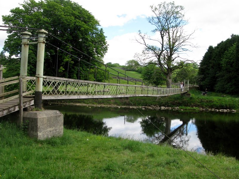
After crossing the bridge at the Western end of the village, we were once again following alongside the River Wharfe through fields and pastures full of with flowers: mostly buttercups and clover. After a couple of miles we passed a bridge across the river to the village of Starbotton and were listening to the loud cries of curlew.
 Sand Martin burrows in river bank
After the same distance again, we took the small detour across a road bridge to the village of Buckden to have a pot of tea or hot chocolate and some ginger cake. We had been here before while on a caving trip to Birks Fell Pot so it was familiar countryside.
Re-crossing the bridge, we were back in fields and pasture land on the bank of the river. Half a mile later we passed through the hamlet of Hubberholme with a pub and a lovely old church with a Norman tower.

Hubberholme Chuch
At the next set of farm buildings at Yockenthwaite, we crossed a bridge to the road and on checking the map realised we had gone wrong as we should have stayed on the other side of the river. Re-crossing the bridge, it began to drizzle again which it had been doing off and on for while.
Yockenthwaite Stone Circle
We stopped at Yockenthwaite Stone Circle which is about 20 feet across and made of about 30 small boulders. A bit further along, at 13:45 we stopped for lunch.
Half an hour later we were on our way again. We arrived at Deepdale and again crossed the river by road bridge. This was where we had parked on a caving trip to Hagg Gill Pot a few years ago.
The drizzle started again and soon worsened to light rain. We sheltered under a hawthorn tree and I replaced the Paramo smock with a Rab Bergen jacket and we both put on waterproof trousers.
Continuing onwards along the river which varied in water flow as water sunk and reappeared, we crossed a footbridge and passed the farm buildings of Beckermonds. where unfortunately not only did we leave the side of the river, but we had to walk on the road for over a mile. Luckily it is a quiet road with very little traffic.
We passed the very nice building of Oughtershaw Hall now with light rain again. Soon we saw a sign pointing along a farm track to Nethergill Farm and also our accommodation for the night, Swarthghyll Farm.
Swarthghyll Farm
After passing Nethergill Farm, we could see a farm in the distance. Surely, we though that couldn't be Swarthghyll Farm - it looks much too far away! Looking at the map confirmed it was the right direction. Luckily, after passing a rise in the track we saw Swarthghyll Farm a few hundred feet away.
 Our accommodation for the night with the brown door
We arrived at 17:45 and found a door in the farmyard with a notice and Karen's surname. We opened the door to our single bedroom flat for the night. The arrangement was that an evening meal and breakfast would be ordered and the food would be left for us to cook ourselves. So we had a very nice Cottage Pie and then watched the television until after 23:00 and then went to bed.

Saturday, 12 June 2010

The Dales Way - Appletreewick to Kettlewell (11 1/2 miles)

After an excellent Full English Breakfast at the pub at 09:00 we settled up our bill and arranged to leave our bag in the bar so that the “Sherpa Van” service could collect it later and deliver it to Kettlewell Youth Hostel. We were away at 09:30 and walked about a quarter of a mile down the road on another sunny day which was breezy and not too warm. Following an an enclosed path past a very large and busy camp site, we were soon once again walking along a footpath running alongside the river Wharfe.
 New Inn, Appletreewick
Soon we reached the bridge across the river at the lovely village of Burnsall. There was a Tea Shop busy with cyclists and next door a village shop. I bought some orange juice and some fudge and Karen also bought a snack and we sat on a bench overlooking a large green area next to the bridge as ducks waddled over to see if they were in luck and could cadge any food off us.
Burnsall Bridge
After our quick snack we crossed over the road from the bridge and followed a path past the Red Lion pub next to the river. We passed a couple of fishermen and arrived at a narrow pedestrian suspension bridge crossing to the opposite side of the river. After following along the river bank and across a large pasture, which missed a loop in the river, we saw some houses on the opposite river bank with a footbridge crossing over.
Suspension Foot Bridge
This was the small village of Linton Falls. The Falls themselves are not very large and were below the far side of the bridge. We saw on the map that there was a Public Toilet nearby, so we decided to make use of the facilities.
 Linton Falls
Afterwards we retraced our steps and re-crossed the bridge. Continuing along wide river bank we arrived at Grassington Bridge which is built of stone and carries a busy road.
 No Camping Allowed!
We crossed the road which crosses the bridge and then followed the roadside footpath for a short distance into the quite large village of Grassington and were soon in the lovely Market Square. This was quite crowded as the Bradford Grammar School Big Band were giving an open air concert. We went into a nearby Tea Shop and had a pot of tea and toasted tea cake. Karen returned to the Market Square to get some cash from an ATM.
 Market Square, Grassington
Walking uphill past the old Town Hall, we followed a small road and then along a lane to fields. We had left the river Wharfe for open limestone country with their network of drystone walls.
Following a well-marked route we arrived at a large lime kiln and decided stop for lunch which would be sandwiches we had bought earlier in Grassington.
 Lime Kiln
After our stop we continue on our way along the Dales Way, pausing to look at Conistone Dib, which is a dry valley with interesting limestone outcrops and features.
Continuing again listening to the curlews and skylarks; mainly curlews but with a few skylarks and also a few lapwings we clambered up and stood on top of Conistone Pie, which is a natural limestone feature but looks like a tower form the distance. From here were lovely views to the Littondale junction with Wharfedale with Kettlewell in the distance and the imposing Kilnsey Crag opposite.
 Conistone Pie
We followed along wide grass-covered limestone bench beneath a limestone escarpment to arrive at a gate in corner of a wood leading onto a steeply-descending track dropping onto the road to Kettlewell. After following the quiet road for a while, we passed through a gate and numerous fields with some gates and some stiles to eventually arrive at a narrow path leading past some houses into Kettlewell village centre.
 Kettlewell Roof Tops
We soon found Kettlewell Youth Hostel, arriving at 17:40.We booked in and ordered an evening meal and the went upstairs to a 5 bed room to ourselves.
After a shower and changing into clean clothes, we sat in the Lounge for a while then went to the Dining Room for our meals. Afterwards we had a walk around the village and had a quick drink to ourselves in the King Head down the road, again quite busy with customer watching England play USA in the World Cup.

Friday, 11 June 2010

The Dales Way - Ilkley to Appletreewick (12 Miles)

The Dales Way is a long distance footpath of about 80 miles (129 km) situated in the north of England and running from Ilkley to Bowness-on-Windermere. By following as far as possible riverside paths, it offers a scenically attractive route from urban West Yorkshire to the Lake District. We arranged for a large bag of spare clothes, etc. to be taken each morning and dropped off at our evening's destination which meant we had less to carry. This was done by www.sherpavan.com/
Having first dropped of our bag the New Inn in Appletreewick, which was our destination for the day, we the drove to the start of the Dales Way in Ilkley.
It was while we were changing into walking boots that I realised that I had a pair of Karen's walking socks! As all my spare socks were now in Appletreewick we went looking for an outdoor gear shop to buy another pair.
I remembered passing one in the past when driving through Ilkley and luckily it was just a short walk away.
We soon found the shop and while I was looking at socks,Karen spotted a lightweight Marmot waterproof jacket with a reduced price tag. Luckily she had left her purse in the car, so I paid for it!
Karen at the start if The Dales Way in Ilkley

Anyway, we were soon back at the car and on our way. We left Ilkley in warm sunshine and were soon following the River Wharfe. We passed some lovely old houses at Low Mill village. Low Mill used to be the site of a mill and all the houses are either old but in excellent repair or newer but still built sympathetically. Leaving Low Mill via a back road we followed a small lane with a tiny humpbacked bridge, then through the churchyard at Addingham.
The church at Addingham
After passing through another collection of houses at High Mill, again we joined the river after passing through a caravan site. We also passed several groups of youngsters coming in the opposite direction with their large heavy-looking rucksacks giving away the fact that they were on a "Duke of Edinburgh" Award trip.
 A "Bodger" at work in the Woods
A curious large log embedded with hundreds of coins
Later we crossed a stile and passed an old and small Quaker "Friends Meeting House" at Lobwood. Luckily there was a permissive path along the wall next to a busy road, so we were able to avoid walking along the road for quite a distance.
 "Friends Meeting House", Lobwood
The River Wharfe
Eventually we had no choice but to join the road when the path ran out, but this wasn't for too long and there was an adjoining path for part of the distance.
 Ruins of Bolton Priory

Soon we were back on wide pastures following one side of the River Wharfe one more until we arrived at the ruins of Bolton Priory at the village of Bolton Abbey at about the halfway point, and made use of the Tea Shop to have some Cheese and Tomato sandwiches, tea and chocolate cake with ice cream!
Karen spotted a swift's nest near the toilets next to a light fitting.
 Swift's nest
Jackdaw
That being our lunch stop, we continued on our way. This meant passing a trailer selling ice cream so we succumbed to temptation and had one each. Now the path rose uphill after crossing a bridge next to stepping stones, and it was difficult to eat to cream and walk uphill!
 Karen with her latest hairstyle!
We joined one of the various paths through Strid Wood and took a tiny detour to have a look at The Strid. The Strid is a small gap in the rocky riverbed through which the river forces its way through. The name comes from the fact that it is so narrow that you could cross the river in a single stride (more like a leap!). There were warning signs about slippery rocks and deep water,but from the look of the green and mossy rocks, you wouldn't need a warning!
 The Strid
Leaving Strid Wood and once again joining the river Wharfe, we could see what looked like a stone bridge with castellations in the distance. According to the guide book, this was a short aqueduct. We followed the Dales Way signs up some steps and crossed the aqueduct to the other side of the river then along the river bank.
Soon we came to the 17th Century Barden Bridge. Sitting on a grassy bank overlooking the river and near the bridge, Karen spotted some young Goosander chicks swimming around. We were also entertained by cars trying to cross the very narrow bridge with a large arch in the middle so that you can't see any traffic approaching from the opposite side.
 Barden Bridge
Continuing onwards along the wide and flat grassy river bank we kept an eye out for a farm track marked on the map leading to our stopover for the night: the New Inn in the village of Appletreewick. I spotted the track and ahead also the New Inn! We arrived at 18:30 or thereabouts.
After dropping of our gear in the room and having a was, we returned to the bar and ordered some food. It was quite busy (plus there was World Cup football being shown on a large-screen TV) but luckily we found a table and two chairs.
After a nice meal and a couple of drinks, we returned to our room and went to bed at 22:00.

Sunday, 6 June 2010

Bonsall Moor

Karen planned a rest day today especially as it had been raining during the early hours of the morning and the forecast was for more showers. I decided to go for a walk locally and found a 6 mile route in the latest edition of “White Peak Walks – The Northern Dales” which started from home in Winster and went via Bonsall.
 Isolated stone stile
Luckily the rain had stopped as I was getting to leave and it remained dry during the walk with some sunny periods but mostly cloudy. It was cooler than yesterday but quite humid with the wet ground.
Leaving Winster I crossed over to Bonsall by following the Limestone Way which takes a route through fields and meadows. At one point I git very wet legs because of the long wet grass but as my trousers were made of polycotton, they soon dried.
Signpost at junction with Limestone Way
I reached Bonsall after following a path down a short, shallow valley popping out onto the road next to the old Wensleyan Chapel next to the lane leading to Horsedale. Following the gradualy-rising route up Horsedale, I reached a green lane and crossed more fields to reach a dirt track with views across to the top of the Via Gellia, the large quarry at Grange Mill and the hill of Minning Low with its tree-surrounded Neolithic round barrow on top. It's surprising how many locations you can see Minning Low from in the Peak District.
 Ruined stone barns and wild flowers
From the dirt track I followed a route via large grassy meadows full of wild flowers with the skylarks singing, until I reached the minor road of Bonsall Lane and crossed over via a stile into another field which I crossed then across another green lane then down the steep field overlooking Winster and down past the large rocks of Wyns Tor.
 Sheep sheltering in the shade by Wyns Tor
A lovely walk mostly through fields and pastures with very little mud and quite a few old capped mine shafts.
All that remained was to make my way through a couple of jitties (narrow passages which wend their way through the village) to pop out at the foot of West Bank, then round the corner to home.
 Returning to Winster
I was wearing Contour Navigator boots, a pair of old Troll poly-cotton trousers and Osprey Kestrel 38 rucksack.

Saturday, 5 June 2010

Lathkill Dale

Breakfast as usual in the Old Smithy café in Monyash with Keith and Pete, who were planning on another digging session in Water Icicle Close Cavern. Then Karen and I walked down the Bakewell Road to the start of Lathkill Dale. It was very warm, but luckily cloudy, so not as hot as it would have been under the full sun.
 Chaffinch on a Signpost
Near Ricklow Quarry we heard a sheep continuously bleating to our right. Karen went to investigate and found a sheep which had got itself tangled in a wire fence. Before Karen had reached the sheep, it had freed itself and run off. So, we left the sheep to do its sheepish things and we followed a rising path on our left which brought us through part of Ricklow Quarry and then along the edge of Lathkill Dale.
 View Down into Lathkill Dale
There were lovely views down a long stretch of the Dale and we could see the numerous walkers below threading their way along the path in the bottom of the Dale while we had our path to ourselves.
We continued on our way, pausing at vantage points to take photos. We reached the limestone tower of Parsons Tor with the opening of Lathkill Top Cave down below. We passed an optional way down to the Dale bottom opposite Cales Dale via steep steps and a path wending its way along the side of the Dale and continued to a smaller Dale joining from the left.
After following a way down steepish grass to reach a path following the subsidiary Dale's bottom we passed by a cave passage leading below a large Rake and soon were at the River Lathkill and the bottom of Lathkill Dale.
We turned up the Dale and followed the river bank passing Coots and Moorhens nesting on little islands of twigs in the river.
 Moorhen on Nest
Reaching a scree slope leading to what looked like a small rock shelter and small opening which we had seen earlier from the top of the Dale side, I scrambled up the scree and investigated. The suspected rock shelter turned out to be just that and the opening below a clump of greenery proved to be to small to enter despite all the bare soil indicating something at least regularly went in and out of the hole.
Sliding back down the scree slope to rejoin Karen, we continued on our way until we reached the footbridge across the river to the foot of Cales Dale. Following a group of walkers along the path up Cales Dale, we branched right towards One Ash Grange farm while the others crossed to the other side to follow stone steps up the Daleside.
We followed the rocky path along a small limestone crag, up rocky steps and past a small passage which looked like it was possibly a trial dug out by miners in search of lead but was only a few metres long.
 Limestone Steps
 Fossil Coral on Steps
Soon we were at the farmyard of One Ash Grange and passing the small limestone grotto, which still has its Christmas Nativity figures! After looking at the small stone-built pigstyes with their stone feeders, we passed through a gate with a cattle grid and then along a farm track leading higher up Cales Dale.
 Old Pigstyes
We had considered taking a three mile detour round-trip to have a look at the stone age monument of Arbor Low but decided to forgo that option today. So, we took an alternative path which led across several large fields. At one particular field Karen went to investigate a circular drystone wall (which turned out to be surrounding a large Dew Pond) while I continued slowly, until Karen caught up, down towards our target: the stile in the lower corner of the field.
As I was walking down the field, an aircraft approached and passed over head and seemed to be a Spitfire! It must have been returning from or heading to a display somewhere. I then spotted a reddish-brown hare in the adjacent field and shouted to Karen and pointed to it as she made her way towards me.
 Spitfire
We soon reached a narrow enclosure between drystone walls with a well-worn path which gradually widened to become a farm track. We followed this for a short distance back to the village of Monyash at the junction with Derby Lane.
 Monyash Village Pond

After a quick look at the mere (Village Pond), we headed straight for the café again, this tome for an ice cream.
I was wearing Inov8 Roclite 315 for the first time to try out a lightweight alternative to boots, Keela trousers and Osprey Kestrel 38 rucksack

Monday, 31 May 2010

Chelmorton, Taddington, Flagg

The weather forecast for today was the best for the Bank Holiday Weekend and turned out to be true in the sense that it was warm and dry but quite cloudy. There were one or two moments when the clouds were a bit dark and threatened rain but that didn't happen in the end. The sun even appeared for a minute or two.
We met Keith and Pete who were up for three days of digging in Water Icicle (Pete's first visit for months as he has been working in Scotland and had a bad back – Keith has the week off work) at Monyash cafĂ© with stall holders setting up a small market on the village green opposite. Karen and I drove the short distance to Chelmorton and parked outside the Church Inn named after the church of St. John the Baptist opposite.
Church of St. John the Baptist
A very nice 12th Century church with an unusual weather vane shaped like a locust! Apparently this was in connection with St John the Baptist's stay in the desert existing on honey and locusts.
 Locust-shaped Weather Vane
We got our walking boots on and after having a look at the spring which fed the water supply for the village in the past (the peculiarly named Illy Willy stream along which the village was built), we walked a few metres to the start of a bridleway which led us gradually higher and higher above Chelmorton and into a series of fields separated by stiles. Reaching a dirt track we followed a diversion from the triangular route connecting Chelmorton, Taddington and Flagg by walking a couple of kilometres along the track past Five Wells Farm and then carefully crossing a stone stile in the drystone wall which had collapsed, continued across a field then through a small gate into the adjoining field where a Neolithic Chambered Cairn is located.
The cairn was once buried under a mound and was exposed by digging in the 19th Century leaving the cairn's limestone slabs standing proud with the remains of the mound surrounding it. Apparently parts of the skeletons of twelve individuals were found there.
 Neolithic Chambered Cairn
Returning to the dirt track and back to were we had met it, we continued via a stile into another series of fields passing a covered reservoir at Top Sough with two communications masts and a Trig. Point nearby. From here we followed the rest of the ten stiles involved in crossing the fields to the neighbouring village of Taddington. We followed the route description in the guide book we were following and reached a road after a narrow hedge lined path next to a house named Daybreak Cottage but could see none of the stiles mentioned in the book which was the continuation of the route.
We instead followed the road below and the up a path by an old chapel to reach the road above the village which we then followed for a short distance until we met a farm track with a fenced-off pond on the opposite side if the road.
The two of us had a quick look at the pond then sat on a bench beside it for a few minutes before crossing back across the road and then into the field by the farm track. The route brought us through more fields, past a large farmhouse onto a lane. We followed the lane to the right for a short distance, then back into the fields at a stile. Following the route through the fields, we arrived in the village of Flagg.
We had passed the sign for some Tea Rooms when we had driven along the road we were on earlier on our way to Chelmorton, so we decided to walk a bit further up the road past our intended route and have a stop at the Team Rooms for some excellent chocolate tea and a pot of tea!
After the refreshments, we followed the road a bit further, than along a side road to join our intended route at a bend in the road where a path entered more fields at a small gate. Soon we were stopping to strip off jackets as the sun made an appearance and the temperature rose. Following onwards across some more fields we arrived at another road which we followed to a fork and then followed the right-hand choice a short distance back to Chelmorton near where we had started from near the church.
I was wearing Asolo Fugitive boots, Keela trousers, Paramo Fuera Ascent jacket and Osprey Kestrel 38 rucksack

Sunday, 30 May 2010

Shutlingsloe

A better day weather-wise with mostly sunny periods but mostly very windy.
Leaving the car by the Visitors Centre, in Macclesfield Forest near Trentabank Reservoir, Karen and I followed a track parallel to the road which led through woods and gradually upwards until it reached an open area with the large summit of Shutlingsloe ahead.

The last section was steep, but thankfully very short, following steps of gritstone which brought us the the long and narrow summit near the trig point. From here you had a 360 degree view of the surrounding land and across the Cheshire plain with the town of Macclesfield below and hills in the distance.

We dropped down on one side to get out of the wind and check the map which confirmed that we should continue along the summit ridge then drop down a path leading past a farmhouse to a lane at Wildboarclough.
We continued along the lane then at a footpath sign and crossed several fields with views of the surrounding countryside until we saw Ridgegate Reservoir in the distance. All that was left to do was to follow a stony track back to the car park and Information Centre in the Macclesfield Forest.

After dropping our rucksacks back in the car and changing from boots we had a couple of lovely hamburgers from the food trailer parked behind the Information Centre called “Nice Nosh”. This isn't your usual “Burger Van” type of food but excellent locally produced food at very reasonable prices.
I was wearing Asolo Fugitive boots, Keela trousers, Paramo Third Element jacket and Osprey Kestrel 38 rucksack.